How councils are using drone technology and thermal imaging
We recently teamed up with Lincolnshire’s North Kesteven District Council’s Environmental Protection Team to raise awareness of the Smoke Free Zone in the local town using drone based thermal imaging.
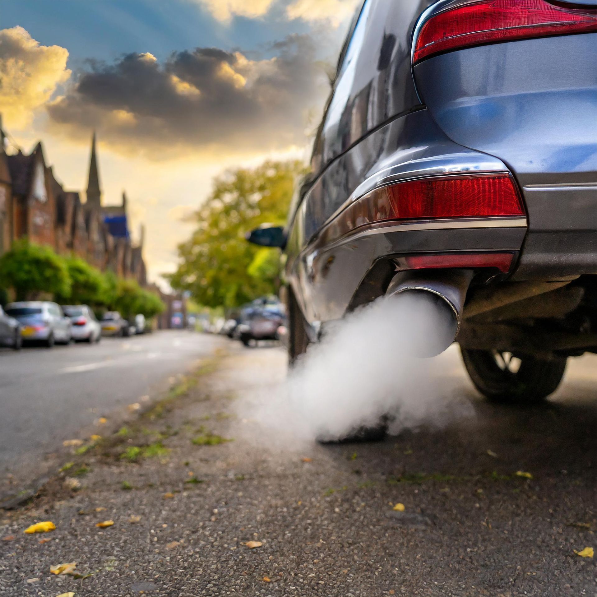
Under the clean air act 1993, smoke control areas are where people and businesses must not emit smoke from a chimney or buy or sell unauthorised fuel for use in a smoke control area, unless it's used in an exempt appliance.
DEFRA has provisioned local authorities with a budget to educate residents, located in these control areas, of their responsibilities under this legislation. There is also scope to identify potential polluting properties and those buying unauthorised fuels with the power to issue fines.
To achieve this, it is important to identify which properties within a control area
have the ability to emit smoke, those that are actively emitting smoke and the method of emission.
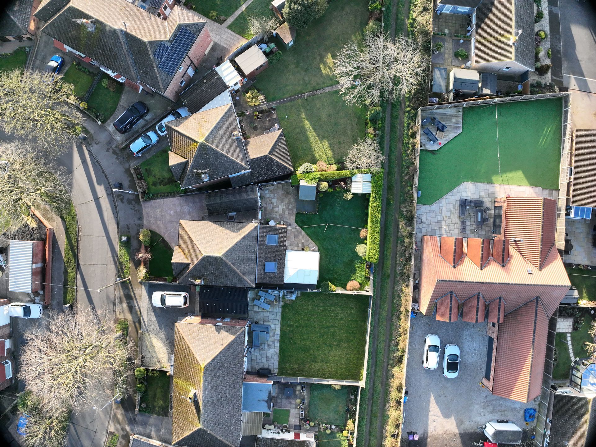
A visual survey of the property would be the most conclusive way to achieve this. The challenge is, how do you carry out this type of survey across hundreds or even thousands of properties?
North Kesteven District Council (NKDC) approached Skytech Cambridge Ltd to assist them with the data collection and analysis of homes located within their ‘Smoke Control Zones’.
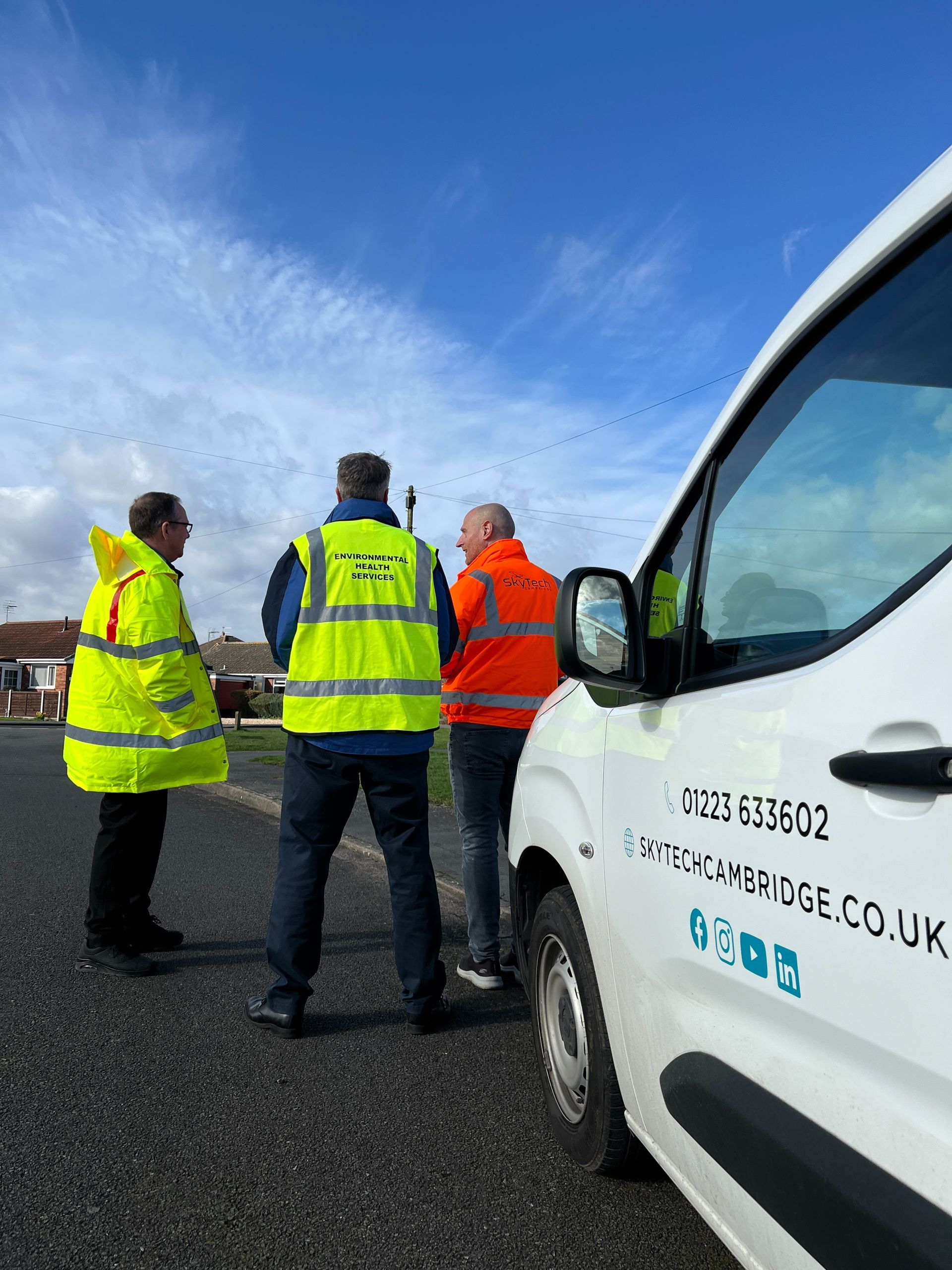
It was important for NKDC to consider the most efficient approach to achieve this with a key focus on its environmental impact.
It would traditionally require a team to travel around in conventional vehicles for several days manually logging data in order to gather the necessary data for each property.
NKDC and Skytech Cambridge knew that there were more efficient and environmentally friendly methods to obtain the required data.
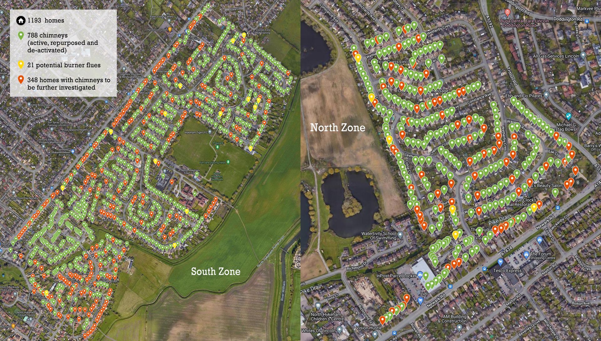
Due to the large area of the SCZ in North Hykeham, it was necessary to split it into two more manageable virtual zones.
North Hykeham - ‘North Zone’
Consisting of 313 Buildings. A mixture of residential and commercial properties reside in this Smoke Control Area.
North Hykeham - ‘South Zone’
Consisting of 880 Buildings. This larger area, comprising a mix of private and local authority residential properties, has a number of large victorian style houses with active multi-room chimney installations.
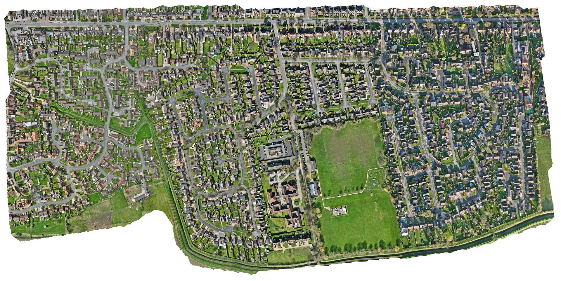
These properties would serve as a benchmark for the data analysis.
Drone Capture:
Using a pre-configured flight path to incorporate all properties located inside the two control zones, a drone was flown over the area in a grid pattern taking
over 35,000 high resolution photos.
The flights are pre-programmed and can be repeated at any time. It allows us to generate data that can be replicated over weeks, months or even years.
Each of the 35,000 photos carries a resolution of 20 megapixels (5280×3956) with precise embedded GPS data and date/time stamps.
This level of detail allows us and NKDC to carry out detailed inspections of any suspected properties. This type of remote inspection would be impossible using conventional satellite imagery.
Map Comparison:
Our high resolution maps carry not only
significantly more detail than Google Maps, they also carry the most up to date information. Google Maps data can often be months or even years out of date.
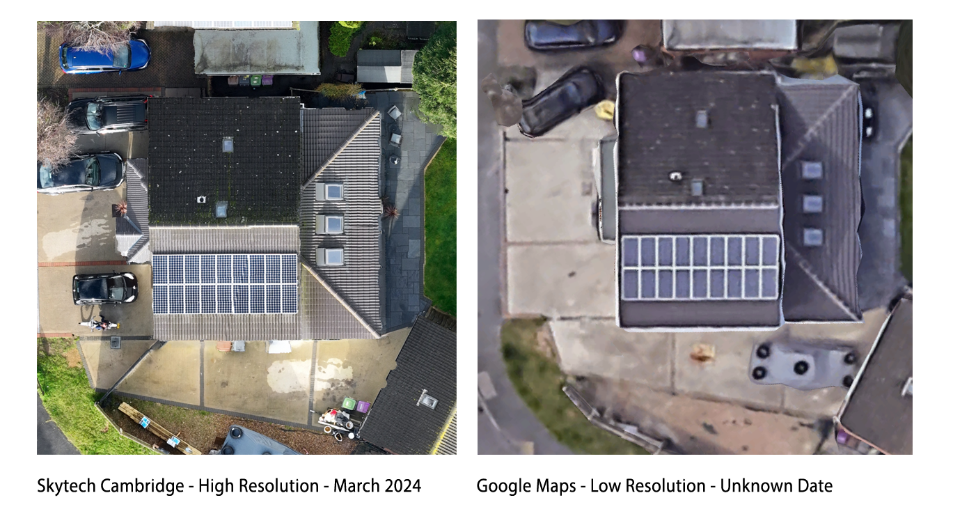
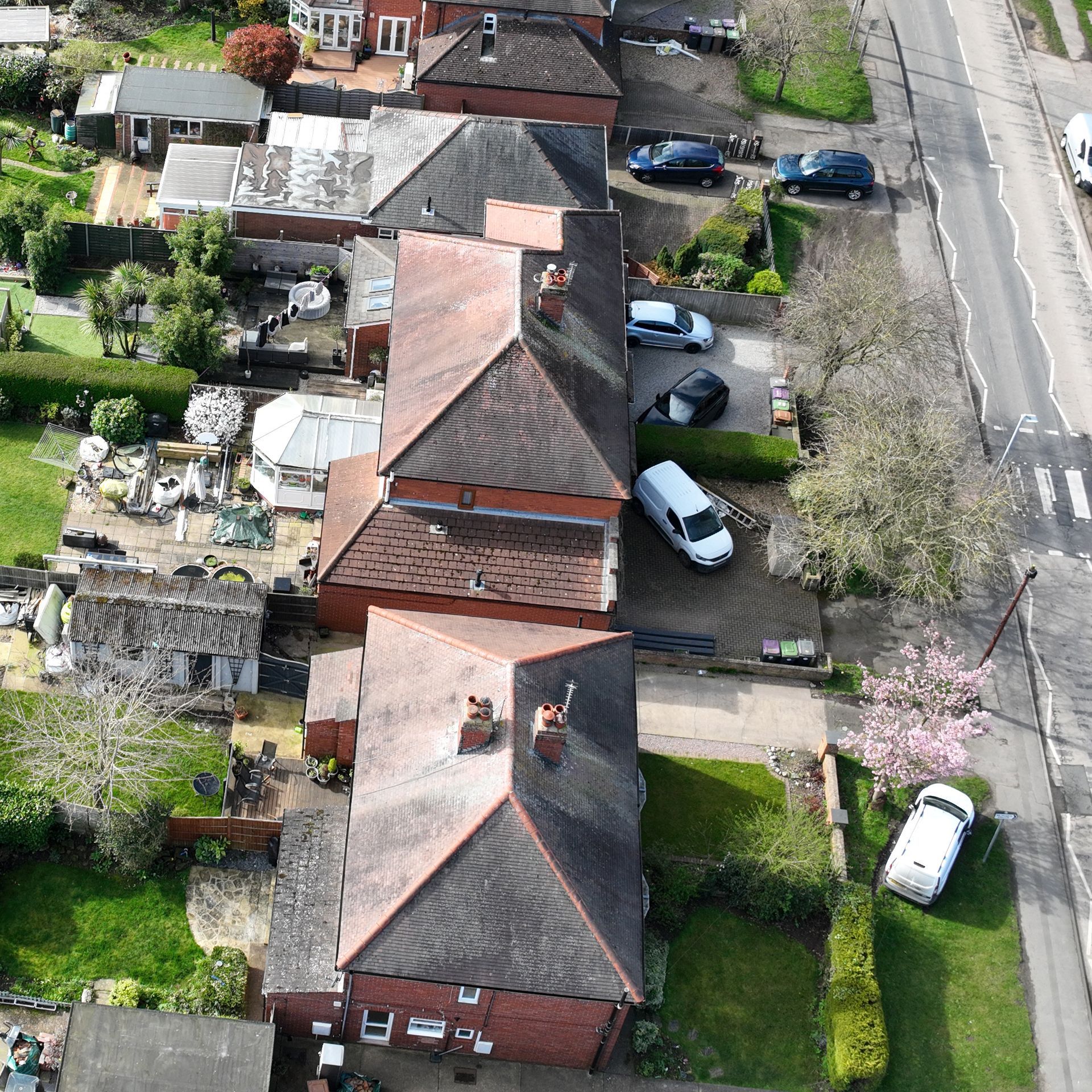
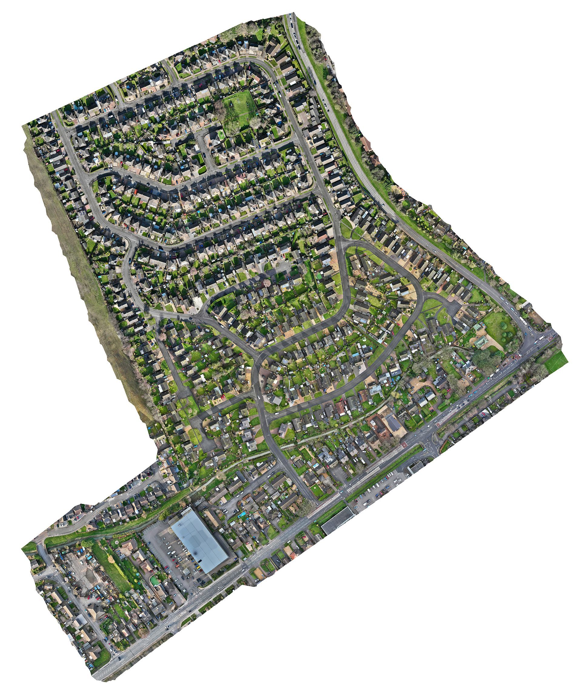
Ultra high resolution map:
We used the resulting photos to digitally ‘stitch together’ and create a composite
ultra high resolution map of the area.
The map (below) is incredibly detailed and would allow Skytech Cambridge and NKDC to carry out a thorough survey of each property without having to leave the office.
It also serves as a captured point in time for future reference.
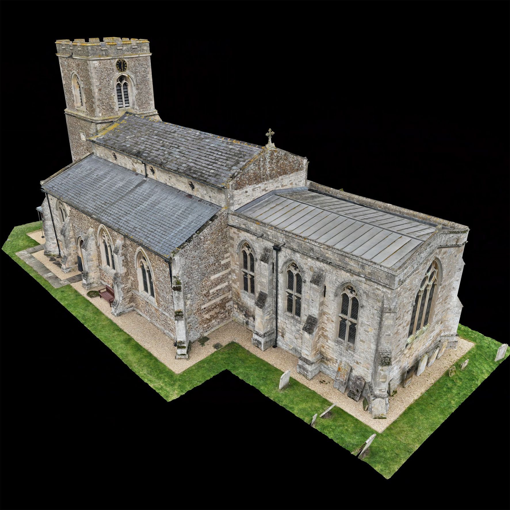
3D digital twin:
In addition to the high resolution map, Skytech Cambridge also processed the collected data to create
complex 3D digital models of both of the control zones.
These fully interactive, correctly scaled and centimeter accurate models of the area are available online via a private link and are accessible for anyone with a web browser.
Thermal Imaging:
In addition to data collected during the daytime, it was decided that the use of our
Thermal Imaging Drones would provide extra insight into
identifying properties with chimneys or log burners. Their unique heat characteristics make them straightforward to identify. Our thermal drones can capture thermal photos and video.
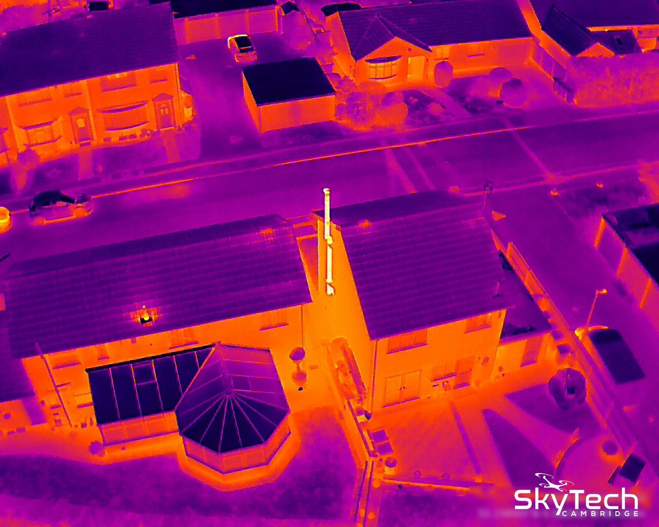
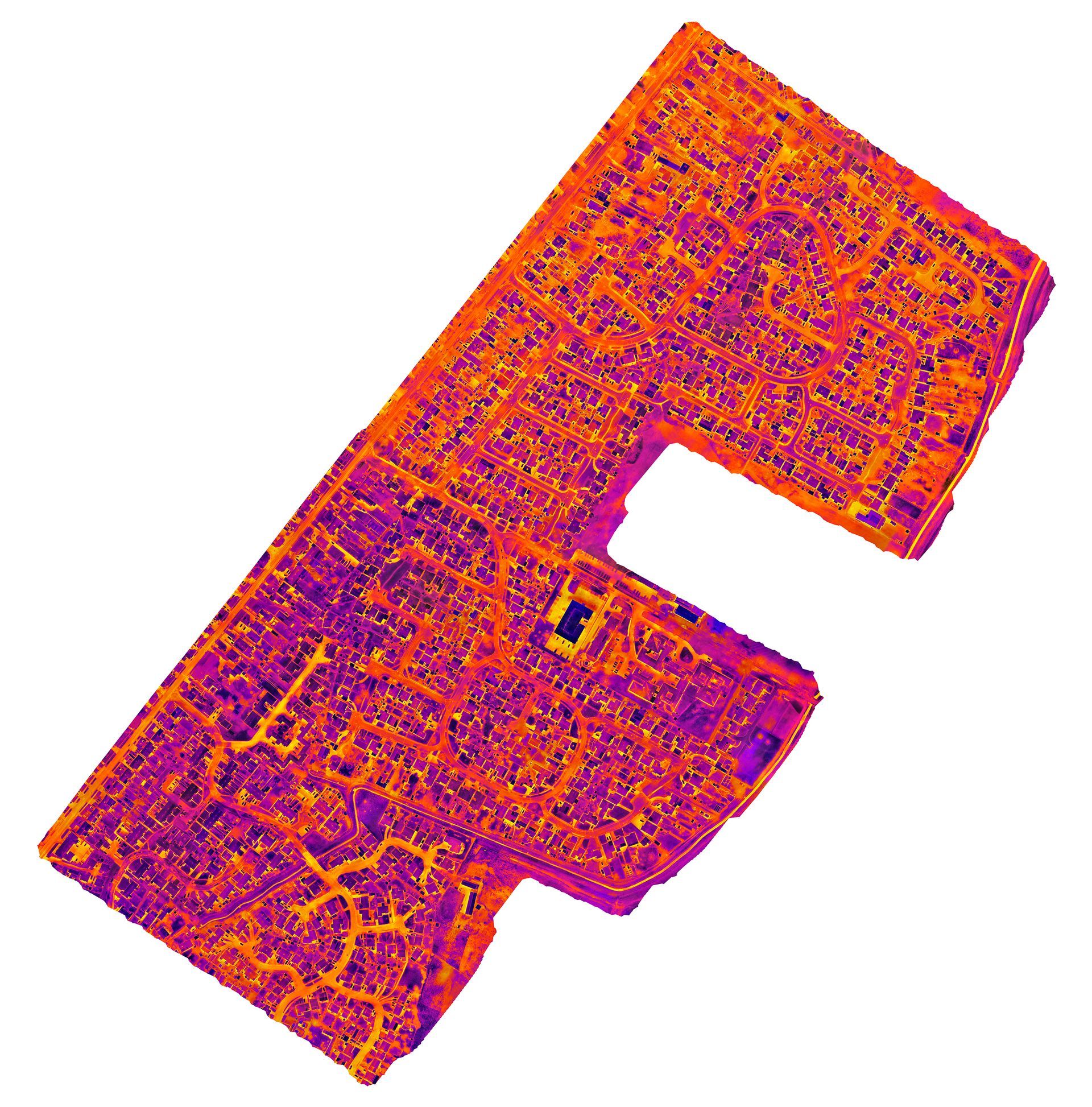
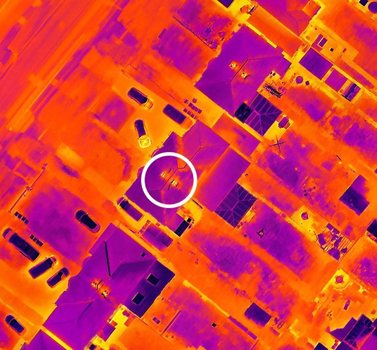
Ultra high resolution thermal map:
In this example, comprising of nearly
14,000 thermal photos, a composite thermal map was created of the ‘South Control Zone’, providing unparalleled levels of detail and insight into each property.
The example below, taken from a section of this map, highlights one house in particular that shows an array of active chimneys which would require further investigation.
Data Analysis:
Using a combination of drone photos, high resolution drone maps, 3D digital twins and thermal imaging media, Skytech Cambridge created a
database classifying each of the properties.
Targeted Analysis:
Once all of the properties had been classified, it was now possible to carry out more targeted evidence gathering. Properties that fitted certain criteria could be re-visited and more precise data could be collected.
Related Drone Services:
We use our drones and expertise across several different sectors to supply real actionable data.
Specific use cases and services related to
Environmental Health include:
- Documenting abandoned vehicles or illegal fly tipping
- Discreet intelligence gathering for investigations
- Documenting flood or building damage
- External roof and high level building surveys including thermal imaging assessments
- Assisting with locating of stray dogs or evidence gathering for complaints against pet owners
In most instances, we can capture the required media (including a
3D digital twin where applicable) along with relevant GPS data and timestamps. We can also compile an associated database or make the raw data available in any format.
Environmental Protection Team Leader,
Peter Rogers said: “We recently received funding for some new engagement in North Hykeham within the two Smoke Control Areas there, and were pleased to enlist the help of the team at Sky Tech Cambridge who deployed drone technology to map out the two zones and detect any particular hotspots for smoke."
“By choosing smokeless fuels, and ensuring your burning appliances are suitable for the type of solid fuel burnt and are maintained properly, everyone can play a vital role in reducing the amount of particulates emitted – meaning we can all breathe cleaner air and better enjoy where we live.”
“The super-high quality imaging generated by Sky Tech Cambridge, both photographic and infrared, are now guiding us in engaging proactively and efficiently with people in the two Smoke Control Areas; to provide helpful advice as well as helping households access any further support where needed. Both teams also worked well together on the ground, liaising in real-time as imagery was collected and answering residents’ questions together about the work."
Great to see our drone is fast becoming part of local authorities’ engagement toolkit; from Cambridge, to Lincoln and beyond.
If you’re interested in how our drone technology can support your local authorities initiatives, please drop us an enquiry via email
info@skytechcambridge.co.uk or our
contact page