Exploring the Ruins of St. James Church, Bawsey: A Historic Site Captured in 3D
A Church Lost In Time
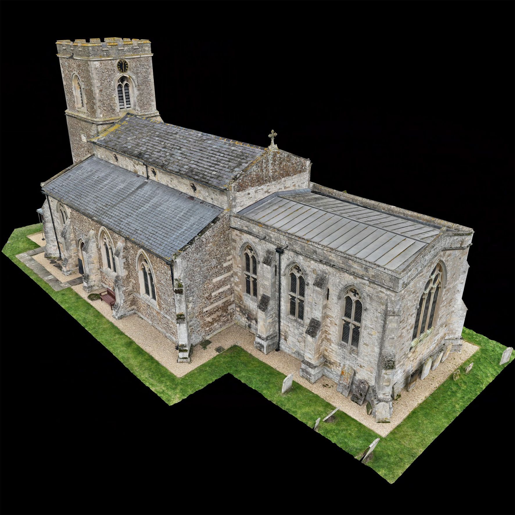
The hauntingly beautiful ruins of St. James' Church in Bawsey, near King's Lynn, stand as a testament to centuries of history, resilience, and mystery. Perched on an elevated site that once overlooked an estuary of the Gaywood River, the church dates back to the early 12th century and is believed to have originally been a Late Saxon minster.
The site’s rich past, coupled with its striking architectural remnants, made it an ideal candidate for our latest 3D modeling project. Using state-of-the-art drone technology, we meticulously captured high-resolution aerial imagery to create an accurate and immersive digital reconstruction of the ruins.
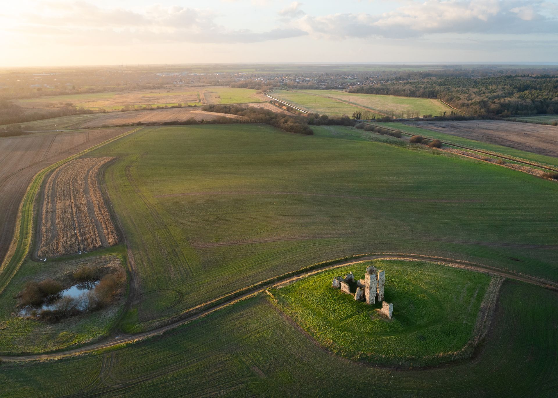
Bawsey was once a thriving medieval village, but as the landscape changed and water levels receded, its population dwindled. By 1517, the church was likely no longer in use, and records suggest it had already fallen into ruin by the late 18th century. Today, the site consists of imposing stone walls, a towering Norman archway, and remnants of a central bell tower, all constructed from locally sourced carrstone, flint, and limestone.
The church gained wider attention in 1998 when the ‘Time Team’ television programme conducted an excavation, unearthing a female skeleton with evidence of cranial injuries. Initial theories speculated she might have been a victim of a Viking raid, but further analysis suggested that the wounds resulted from an ancient surgical procedure known as trephination, performed over 1,300 years ago.
Bringing History To Life With Drone Technology
Recognising the historical and cultural significance of St. James' Church, we set out to create a detailed 3D model of the ruins. Our drones captured precise aerial data, mapping every inch of the remaining structure with photogrammetry techniques. We utilised a combination of oblique and nadir image capture, ensuring comprehensive coverage of every architectural feature. The High-resolution sensor on the drone collected overlapping images, which were then processed using specialised photogrammetry software to generate a detailed 3D point cloud.
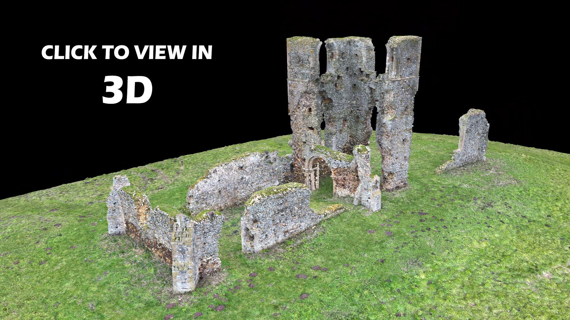
Once the raw data was collected, it was refined to create a high-fidelity digital model. The model was then further processed to generate a textured mesh, enhancing its realism and making it suitable for both research and public engagement.
The benefits of this digital preservation extend beyond academic research. The 3D model enables virtual tourism, allowing people to experience the ruins from anywhere in the world. Additionally, it provides conservationists with an invaluable tool for monitoring structural changes and planning preservation efforts.
For more details about our drone based mapping and 3D modelling work CLICK HERE