Skytech Cambridge Logo

Cambridge City Photographed From A Plane!

Marc Mann • August 12, 2024

Private Plane Flight To Capture The City Center

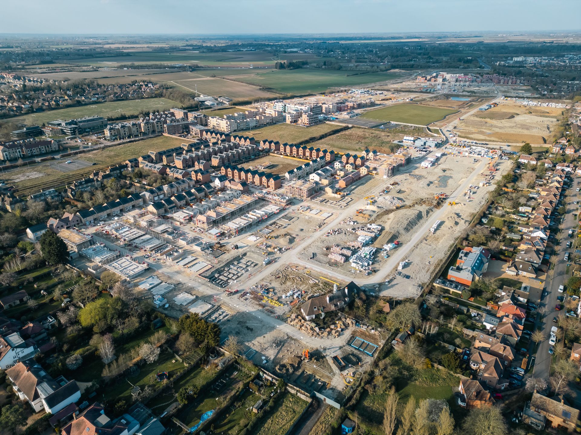
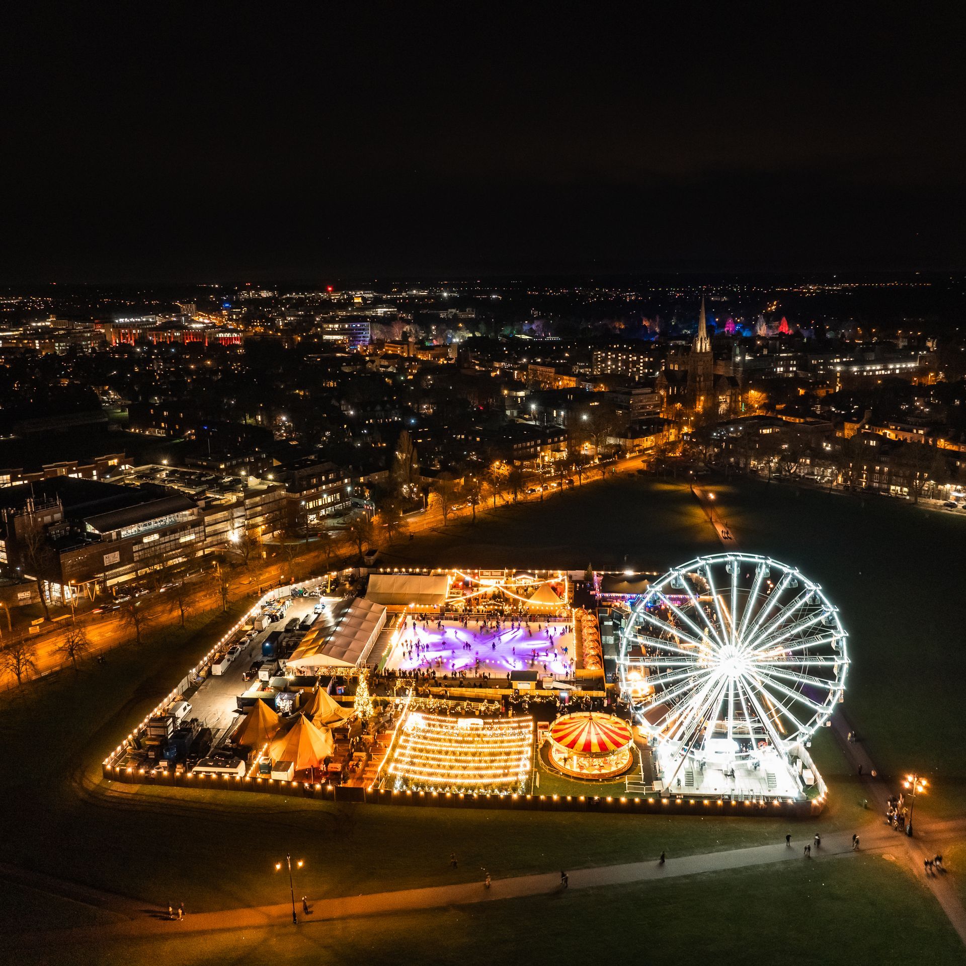
Flying at 2300ft in small plane over Cambridge city center was what it took to capture a series of photos for a regular client recently. Working to a very specific brief meant that it wasn't possible to use a drone due to the extremely wide field of view required for each of the photos. This was something that wasn't possible due to height restrictions relating to drone flights in the UK.


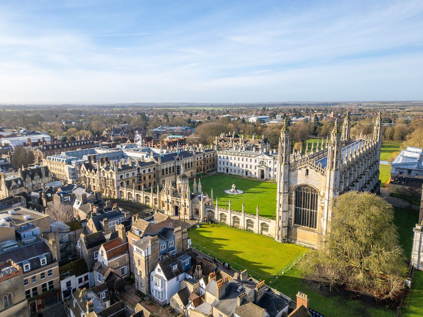
This example photo that we captured shows incredible detail of many of the most notable colleges and other landmarks in the city center. 


We have extensive experience working in the city center and with the city airport to facilitate many commercial drone operations over the last five years. 


If you have a specialist request for aerial photography or videography in or around Cambridge, don't hesitate to get in touch. We have the experience and knowledge to turn requests around quickly and with professional results.


info@skytechcambridge.co.uk

By Marc Mann February 24, 2025
A Church Lost In Time
By Marc Mann February 22, 2025
How Cutting-Edge Aerial Inspections Streamline Historic Building Maintenance
By Marc Mann February 20, 2025
Capturing the Past, Protecting the Future
By Marc Mann December 30, 2024
Cambridge Christmas Market Captured in Stunning Drone Timelapse!
By Marc Mann December 7, 2024
Excitement Grows for DJI Mavic 4 Pro : A Potential Game-Changer for Professional Drone Operations
By Marc Mann November 14, 2024
Revolutionising Survey and Inspection Services with Skytech Cambridge
By Marc Mann October 7, 2024
This is why Drone Roof Surveys can be worth their weight in gold... Unseen defects, such as the one identified above the main entrance to this school reception, have the potential to be incredibly dangerous. If you are building manager and have been putting off assessing your high-level structures due to potential cost or access complications, there is a fast, safe and extremely cost-effective alternative. Our drone surveys can provide you with a 100% oversight of your asset. High-resolution photographic evidence can assist you with: 🔷 Tendering for repairs long before scaffolding has to be called in 🔷 Obtaining accurate material costs from suppliers 🔷 Compiling dilapidation or end-of-work reports 🔷 Providing evidence for disputes, damage claims or quality of work issues Fully insured, highly experienced and working under a high-level CAA authorisation for over five years.
By Marc Mann August 23, 2024
How to secure permissions for drone surveys in London
By Marc Mann August 12, 2024
Mavic 3 Enterprise You Continue To Surprise Us!
By Marc Mann August 12, 2024
Ultra High Resolution Orthomosaic Map
More Posts
Share by: